Things to see
What to visit in Smolyan and within an hour of the town.
In town
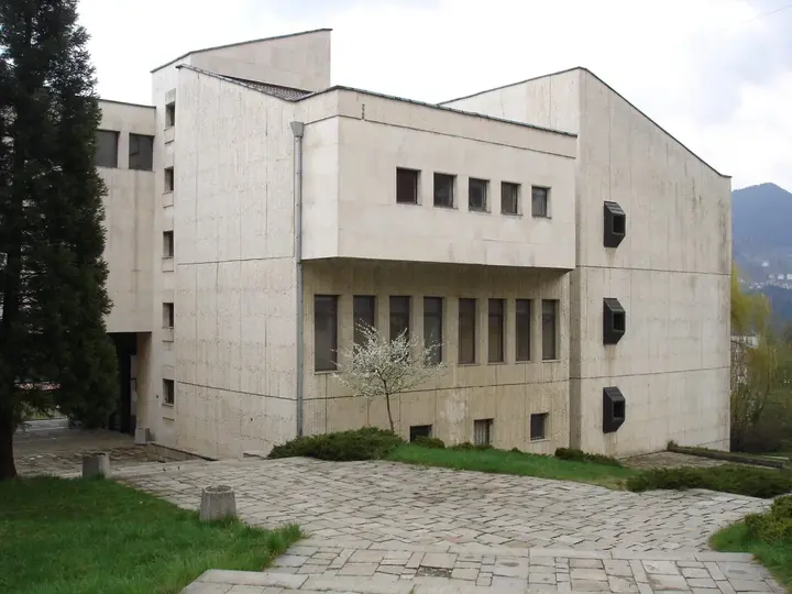 Stoyu Shishkov Regional History Museumin the town centre · Closed, opens at 09:00The largest museum in the Rhodopes, devoted to the history and way of life of the mountains. Since 1983 it has been in the cultural complex in Nov Tsentar, next to the library and the art gallery.
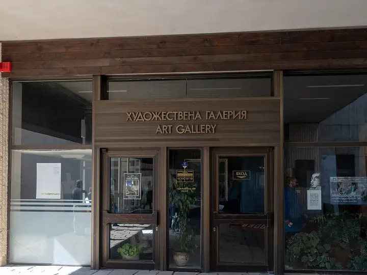 Smolyan Art Galleryin the town centre · Closed, opens at 09:00A gallery in the cultural complex in Nov Tsentar with works from the international painting plein air and from the Rhodopa exhibitions.
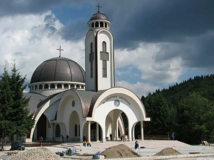 St. Visarion of Smolyan Cathedralin the town centre · Closed, opens at 07:30A large Orthodox church in the centre of Smolyan, consecrated on 2 July 2006. It is easy to spot by its tall bell tower and dome.
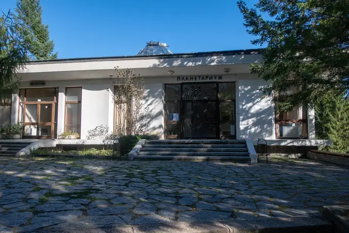 Smolyan Planetariumin the town centre · Closed, opens at 09:00The largest planetarium in Bulgaria, opened in 1975. It has a digital star hall, an observatory with a 14-inch telescope, shows for children and shows in English.
- Alibey's Konakin the town centreThe oldest fully preserved konak (manor) in the central Rhodopes, built in the 18th and 19th centuries as the home and seat of local Ottoman rulers. It consists of three adjoining parts and has been a monument of national importance since 1964. After restoration in 2013 it became a training centre with accommodation, so the building is mostly seen from the outside.
- St. Nedelya Church, Raykovo1 km from the centre in a straight lineA church built in 1836, around which a whole church and school complex grew during the 19th century: a high stone wall, a bell tower, an ossuary and a church house. Above the church stands the school of 1871, now a community centre. The buildings sit on several terraces on the steep slope and keep the feel of old Raykovo.
- Pangalov House2 km from the centre in a straight lineA monumental three-storey house in Gorno Raykovo, built between 1856 and 1860 by master builder Harit Kisyov for the cloth merchant Pangalov. With its woodcarving and wall paintings it is considered one of the finest Rhodope houses and is a monument of national importance. The building is falling into disrepair and local people are calling for its restoration, so for now it can only be seen from the outside.
- Beyski Bridge2 km from the centre in a straight lineAn Ottoman-era stone bridge in the old Smolyan quarter, one of the few Rhodope bridges with a known building date. There were stone inscriptions on both sides of the arch, and one of them gave the year 1720. The bridge has been repaired so it can still be used today, with a new surface and railing. It is easy to include in a walk around Star Tsentar.
Around Smolyan
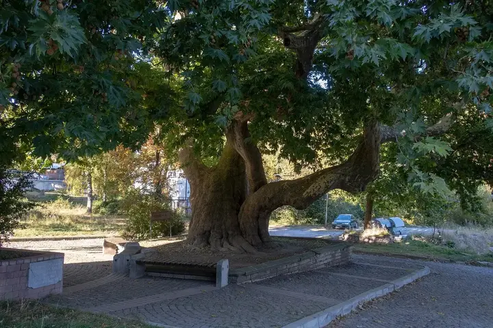 The Old Plane Tree3 km from the centre in a straight lineAn oriental plane tree in Star Tsentar, planted in 1720 from a sapling brought from the Aegean coast. The tree is more than 300 years old and its crown covers about 600 square metres. It once stood on Huriet Megdan, the cultural and spiritual heart of old Pashmakli, and one of the town's two mosques is right next to it. From the bus station it is a few minutes' walk over the footbridge and up the steps.
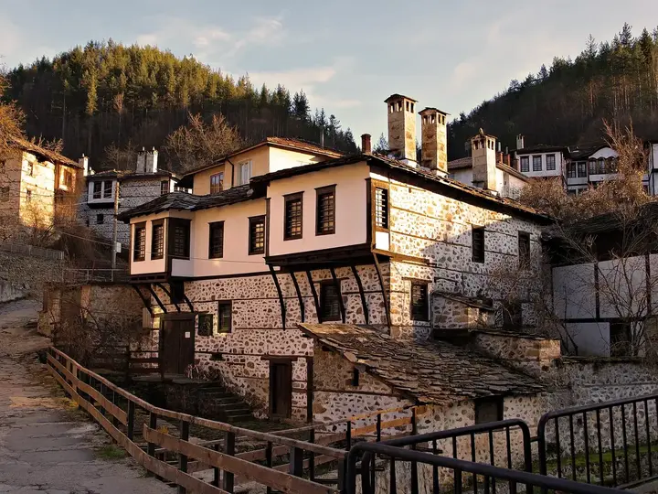 László Nagy House Museum3 km from the centre in a straight lineA museum of the Hungarian poet, translator and artist László Nagy (1925–1978), opened in 1981 in the Gyordzhev House of 1873 in the Cheshitska mahala of Raykovo. Nagy translated a great deal of Bulgarian poetry and folk songs into Hungarian, and the exhibition tells the story of his life and work. The mahala is the oldest part of Raykovo and is worth exploring on foot.
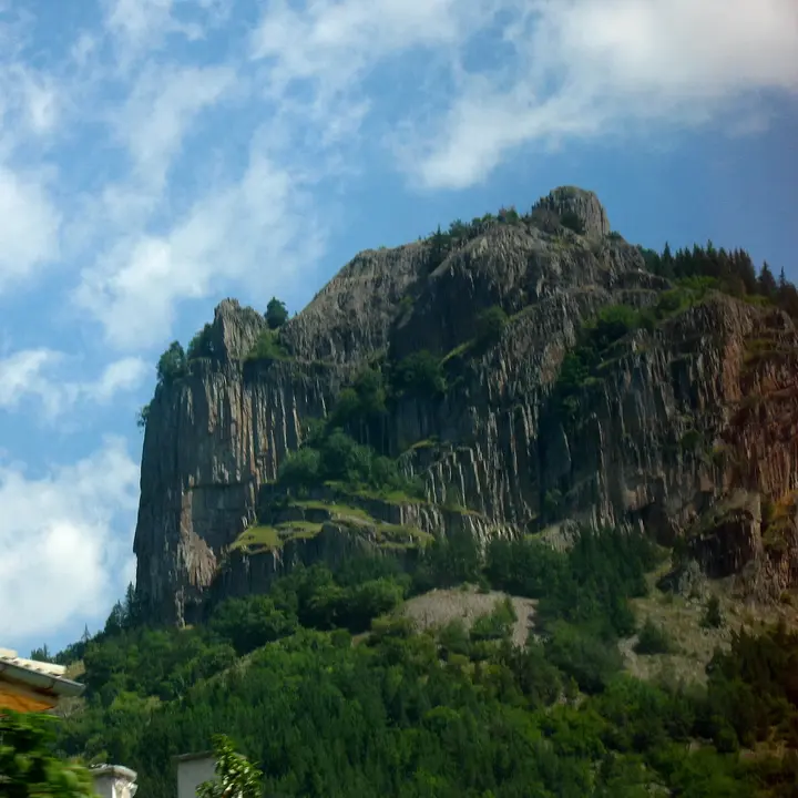 Nevyastata Rock3 km from the centre in a straight lineA rock above Smolyan which, according to legend, a young local woman threw herself from rather than marry the Ottoman ruler of the town. A marked eco trail of about 750 m starts by the arch of St. Panteleimon Monastery on the road to Pamporovo and takes about half an hour. At the top there are two viewing platforms over the town, and nearby there are rock climbing routes, a via ferrata and a zip line, which can only be used with the guides on site.
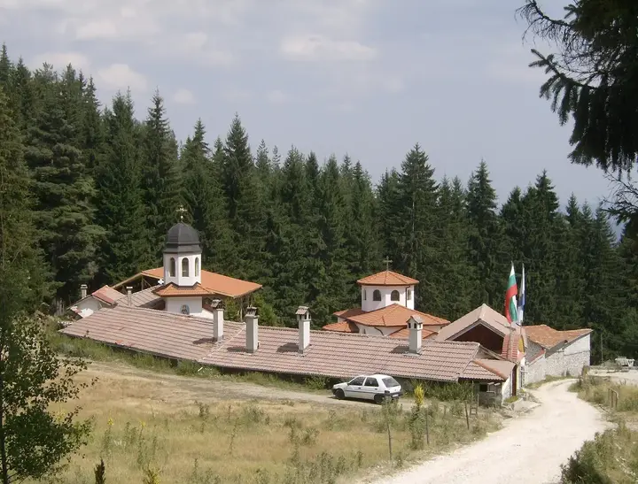 St. Panteleimon Monastery3 km from the centre in a straight lineA working convent in the pine forest on the road from Smolyan to Pamporovo. It was founded by a Bulgarian Muslim woman who converted to Christianity in 1988 and took the name Hristina; the church was built with donations and consecrated in 1998. The monastery keeps relics of St. Panteleimon and of Sts. Cosmas and Damian, and its feast day is 27 July. The car park in front of the arch is where the trails to Nevyastata Rock and Kaleto Fortress begin.
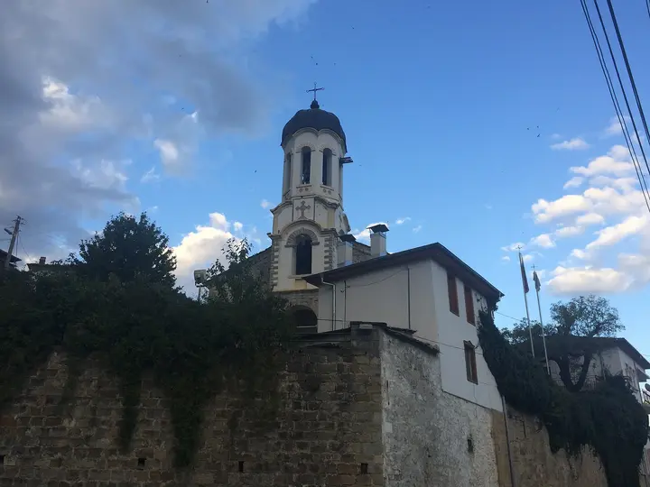 Church of the Assumption, Ustovo6 km from the centre in a straight lineA three-nave church from 1865 with a five-sided apse; its yard holds the ossuary and the old cell school. The church complex is a monument of national importance. It stands just past the traffic lights in Ustovo, a few minutes' walk from St. Nicholas Church and the old houses around it.
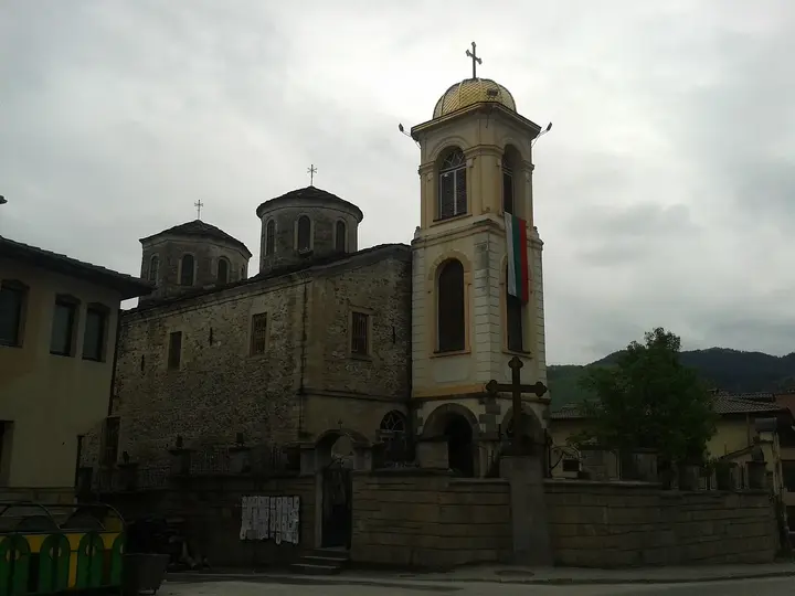 St. Nicholas Church, Ustovo6 km from the centre in a straight lineA church from 1836 that was originally sunk into the ground, as the Ottoman authorities required at the time. In 1883 master builder Vasil Dimov from Yugovo rebuilt it into its present form. In front of the church stands a monument to Pop Gligorko, regarded as the first priest and teacher in Ustovo, and inside there is an icon of St. Nicholas believed to heal and an icon of Sts. Cyril and Methodius painted by Stanislav Dospevski in 1865.
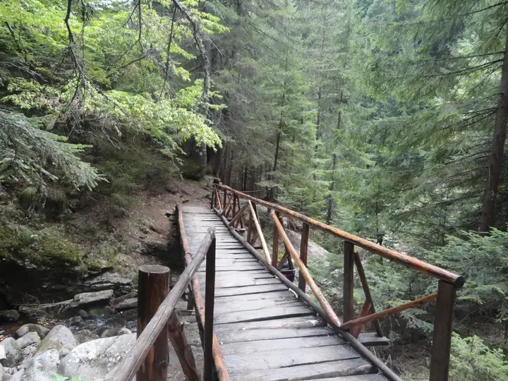 Canyon of the Waterfalls Eco Trail6 km from the centre in a straight lineA trail along both banks of the Gerzovska River through the Soskovcheto reserve, with wooden footbridges and viewpoints. There are 46 waterfalls along the river; the highest, Orpheus, is almost 70 m tall.
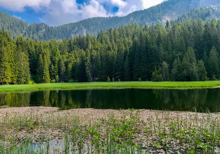 Smolyan Lakes6 km from the centre in a straight lineLakes formed by landslides above the town, below Orpheus Rocks and Snezhanka Peak. There used to be twenty; seven remain today, and the three highest are linked by an eco trail.
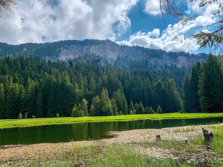 Orpheus Rocks7 km from the centre in a straight lineA rocky summit at about 1,880 m next to Snezhanka Peak, with a view of the Smolyan Lakes stepping down towards the town. Legend has it that Orpheus sat here to find inspiration. It is about a 20-minute walk across the meadows from the top station of the chairlift or from the saddle below Snezhanka, which has a paved road.
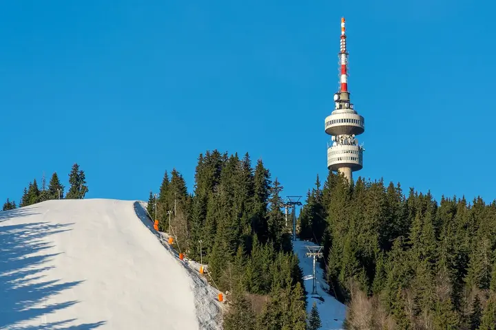 Snezhanka Peak8 km from the centre in a straight lineThe highest peak in Pamporovo, 1,926 m, crowned by a 156-metre television tower built in 1978. Ski runs start from the summit, and Orpheus Rocks and the Smolyan Lakes are within walking distance. You can get up by chairlift from Pamporovo or by a paved road. The tower's viewing terrace is not always open, so check on site.
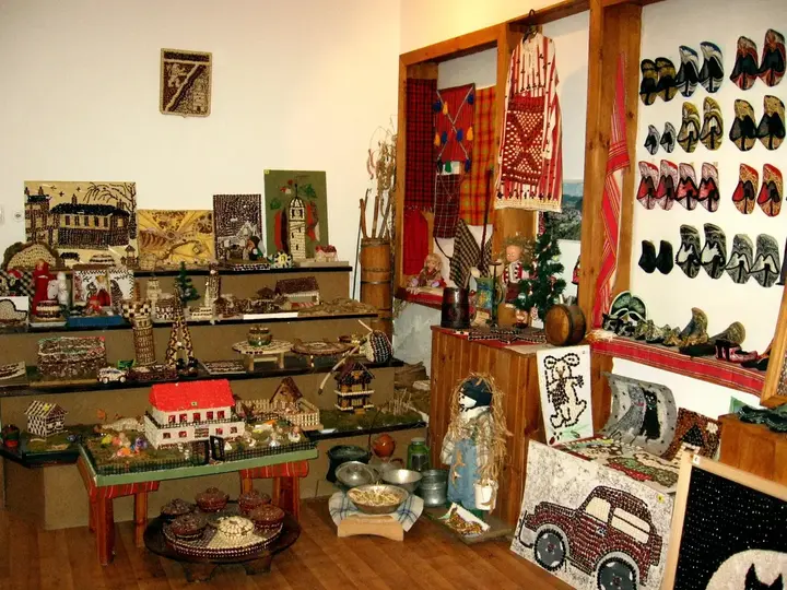 Smilyan Bean Museum8 km from the centre in a straight lineThe Smilyan Beans and Rhodope Slippers ethnographic collection in the Smilyan community centre, where figures, panels and decorations are all made of beans. It holds a large panel made of 23,045 bean halves, each glued on by a different visitor, as well as traditional Rhodope slippers. The village also has a stone clock tower from 1864, the only one in the municipality.
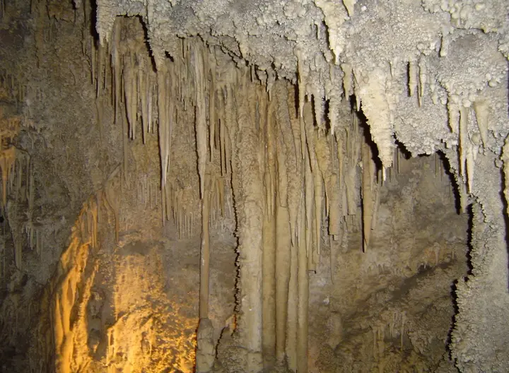 Uhlovitsa Cave8 km from the centre in a straight line · Closed, opens at 10:00A show cave above the left bank of the Arda River, near the village of Uhlovitsa. It is about 460 m long and takes its name from the tawny owl (ululitsa) that lives in the area.
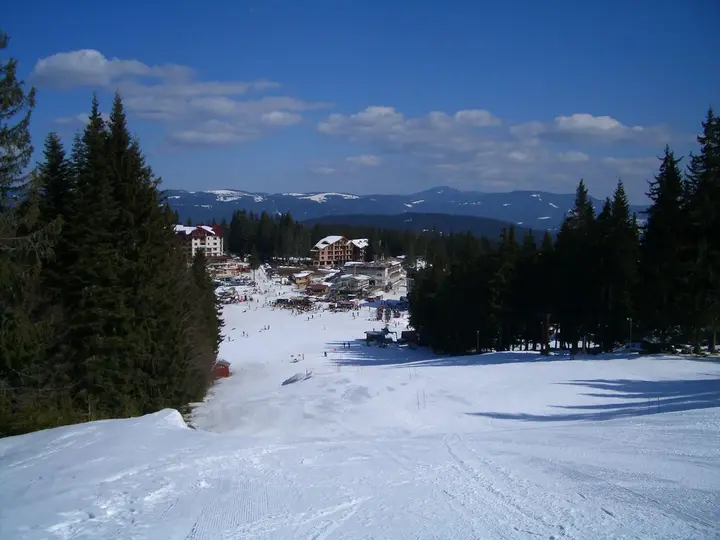 Pamporovo9 km from the centre in a straight lineOne of the largest mountain resorts in Bulgaria, north of Smolyan. In winter it is a ski centre; the rest of the year it is a starting point for walks and cycling.
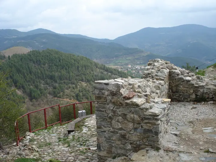 Momchil's Fortress10 km from the centre in a straight lineA fortress on a rocky peak at 1,215 m above the village of Gradat, built under Emperor Justinian I in the 6th century and rebuilt in the 11th. In the 14th century it was linked with Momchil Yunak, who ruled the Rhodopes almost as an independent lord. The path to the top is about 1 km and takes half an hour, and the view is open in every direction.
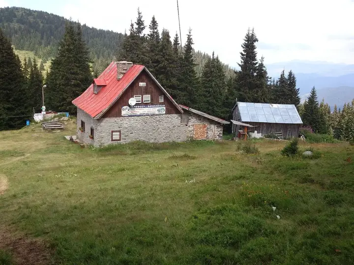 Perelik Hut11 km from the centre in a straight lineA mountain hut below Golyam Perelik with a main building and two seasonal bungalows, 35 beds in total, plus a dining room and kitchen. It is reached by 5 km of asphalt and gravel road from the Prevala saddle on the road to Shiroka Laka, and marked trails lead from it to Orfey Peak, Gela, Mugla, Lednitsata Cave and the Canyon of the Waterfalls. The hut is a stop on the European long-distance path E8; it is best to call ahead.
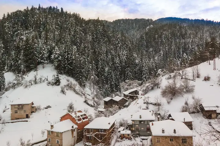 Momchilovtsi11 km from the centre in a straight lineA large Rhodope village 14 km from Smolyan with the Church of Sts. Constantine and Helena from 1836, built by local stonemasons, and a history museum with more than 3,000 exhibits and a small art gallery. Dozens of chapels around the village are linked in three walking routes, and the Dupchov Kamak and Kardzhaliyski Kamak rocks are nearby. The church is one of the 100 National Tourist Sites.
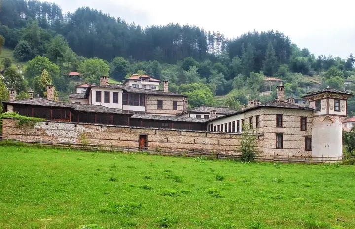 Agushevi Konatsi11 km from the centre in a straight lineA large feudal manor in the centre of Mogilitsa, built over some 20 years from 1820 by three master builders for Salih Agha and his three sons. It has 221 windows, 86 doors and 24 chimneys, and the buildings stand around three successive courtyards with living quarters and farm buildings. It has been a monument of national importance since 1964.
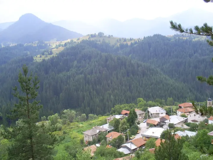 Solishta13 km from the centre in a straight lineA small village near Shiroka Laka known for Chernocheto, a protected forest of 300-year-old black pines so thick that two arms cannot reach around them. Above the village rises Turlata Peak (1,822 m) with the remains of an early 10th-century fortress, and from there you can see the Chernatitsa ridge and the Shiroka Laka valley.
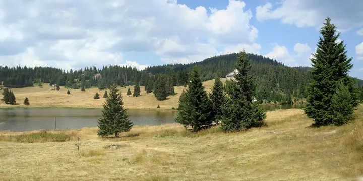 Kutela and Haydushki Polyani13 km from the centre in a straight lineKutela is a quiet village on a hill at 1,220 m above the Malka Arda River, 6 km from the Haydushki Polyani resort area. People have lived here since Thracian times, and the border between Eastern Rumelia and the Ottoman Empire once ran past the village. The folk singer Veselin Dzhigov was born in Kutela, and Haydushki Polyani has a lake, holiday homes and a monument to those who died in the Ilinden-Preobrazhenie Uprising.
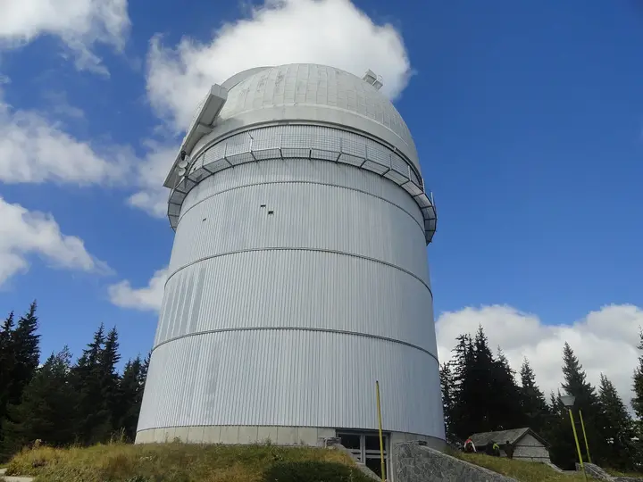 Rozhen National Astronomical Observatory13 km from the centre in a straight lineThe largest astronomical observatory in Southeast Europe, opened in 1981, with a 2-metre telescope. On daytime visits groups go under the dome of the big telescope and hear a short talk, but there is no observing through the telescope.
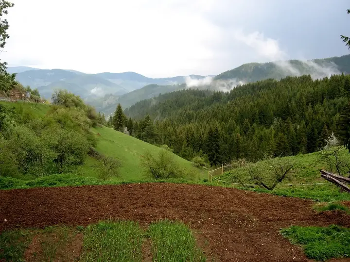 Gela14 km from the centre in a straight lineA high mountain village at 1,400 to 1,500 m at the foot of Orfey Peak (2,188 m), the second highest in the Rhodopes. Legends link Gela with Orpheus, and the village is known for its bagpipers. Marked trails lead from here to Orfey Peak, Perelik Hut and Golyam Perelik.
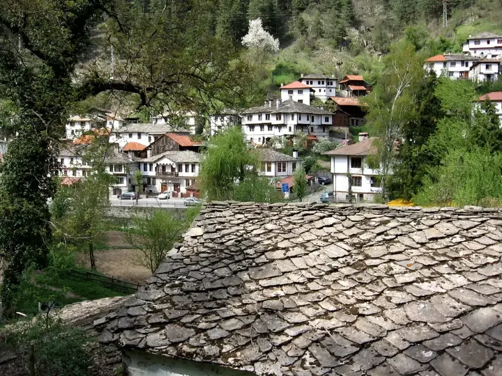 Shiroka Laka16 km from the centre in a straight lineAn architectural and folklore reserve with well-kept Rhodope houses, among them the Zgurov, Uchikov and Grigorov houses. The Church of the Assumption was built in just 38 days in 1834 and has a valuable iconostasis, and next to it stands the old school of 1835. The village is home to the National School of Folk Arts, and at the end of winter it hosts the Pesponedelnik mummers' festival. It is best explored on foot along its cobbled lanes.
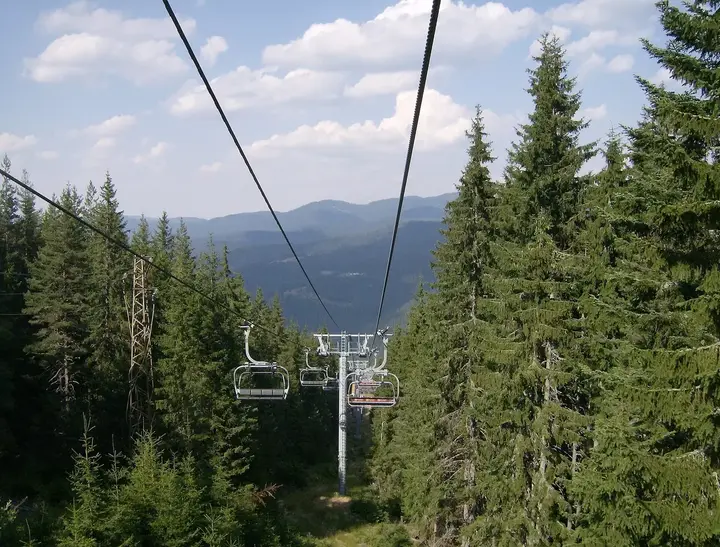 Chepelare and Mechi Chal Ski Area17 km from the centre in a straight lineA mountain town at the foot of Mechi Chal Peak (1,873 m), whose ski area has 12 runs with a total length of 20 km, including one of the longest in Bulgaria. A four-seat chairlift takes you to the top in 9 minutes, and since the 2016/17 season the area has been linked with Pamporovo. Outside winter the slopes are good for walking, and the town is home to the Rhodope Karst Museum.
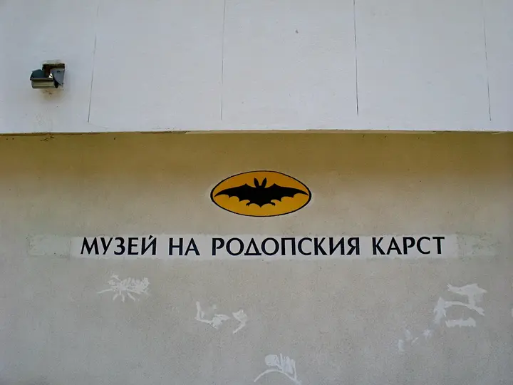 Rhodope Karst Museum17 km from the centre in a straight lineA museum in Chepelare opened in 1980 from the collection of the Studenets caving club, which explored nearly 200 Rhodope caves. It holds more than 4,000 specimens, including a complete cave bear skeleton, the jaw of a cave leopard and a bronze axe from Chaya Cave. There is also a mock cave that shows cave formations as they look in their natural setting.
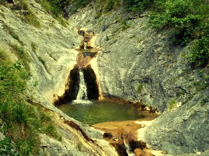 Kazandzhi Dere Waterfalls19 km from the centre in a straight lineA deep ravine near Mugla where the water has carved cauldron-like pools and small waterfalls into the rock. Start from the centre of Mugla and follow the river downstream; there is a sign after the footbridge over Tenes Dere, and the falls are about half an hour away. The Kazanite reserve is nearby. The rocks are very slippery when wet.
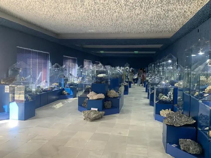 Rhodope Crystal Hall21 km from the centre in a straight lineA mineral exhibition in the centre of Madan, set up in 1984, with nearly 600 specimens from the mines of the area. The largest crystal measures 60 by 60 cm, and the hall is a member of the International Association of Mineralogical Museums. The Mining Museum and the Spoluka underground museum are nearby, with a combined ticket for all three.
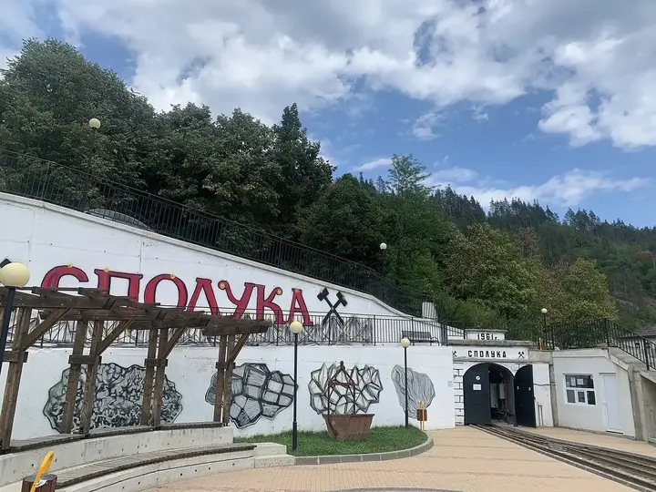 Spoluka Underground Mining Museum21 km from the centre in a straight lineA former lead and zinc mine next to Madan that worked until 1972 and is now an underground museum. The complex is about 140 m long, with a horizontal gallery, a mine yard and a vertical shaft, and shows how ore was mined in the Rhodopes. A combined ticket also covers the Crystal Hall and the Mining Museum.
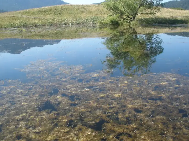 Chairski Lakes22 km from the centre in a straight lineSeven landslide lakes at about 1,400 m in the protected Chairite area, east of Trigrad. The best known is the Blue Lake, surrounded by old forest, where fallen trees and islands of sphagnum moss give it a fairy-tale look. It is a quiet place for a walk through the woods.
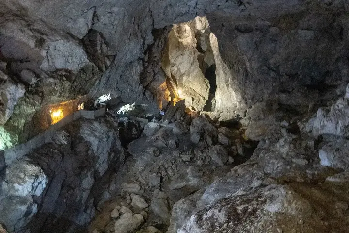 Devil's Throat Cave28 km from the centre in a straight lineA cave at the start of the Trigrad Gorge where the Trigradska River plunges 42 m into the huge Roaring Hall, 110 m long and up to 35 m high. You enter through a 150-metre man-made tunnel and leave by climbing 301 steps beside the underground waterfall, so you need to be reasonably fit. Visits are guided.
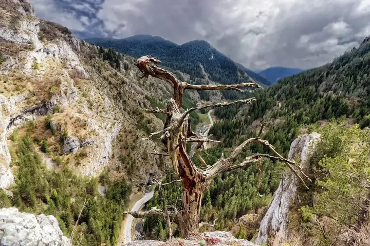 Trigrad Gorge28 km from the centre in a straight lineA gorge of the Trigradska River about 7 km long, cut up to 300 to 350 m deep into marble. The western wall rises to 180 m and the eastern one to 350 m, and in places the road runs between them as if through a corridor. The Devil's Throat and Haramiyska caves are here, and the gorge is easy to see by car with short walks.
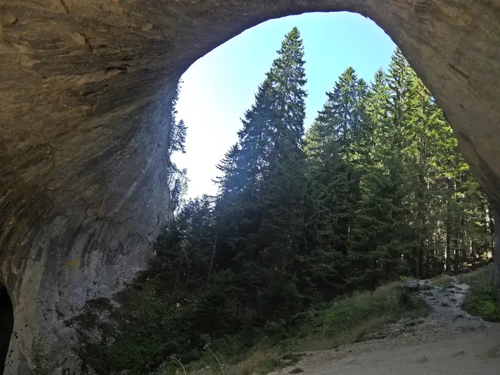 Wonderful Bridges29 km from the centre in a straight lineTwo marble rock bridges in the valley of the Erkyupriya River below Golyam Persenk Peak, left behind when the roof of an ancient water cave collapsed. The larger bridge is almost 100 m long and its highest arch is 45 m; the smaller one is 200 m downstream. They are reached by 18 km of paved road from the turn-off at Sinite Hancheta on the road to Plovdiv, and there is a hut next to them.
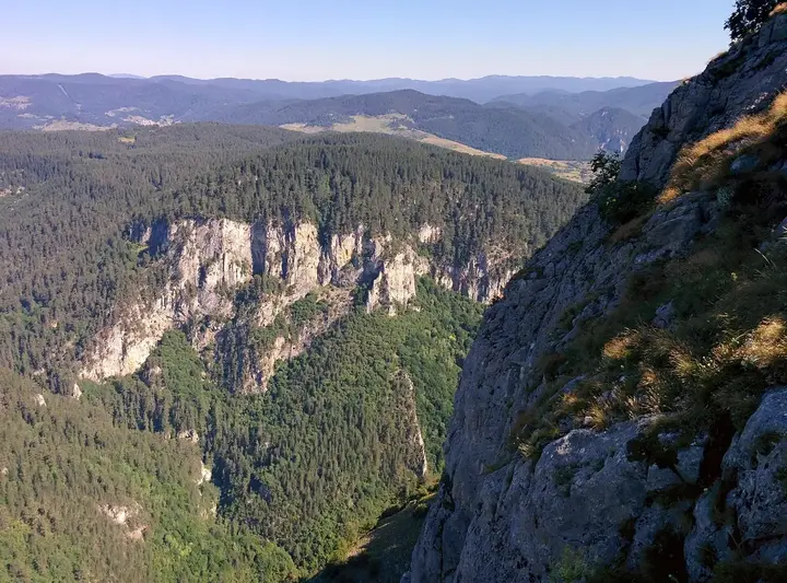 Orlovo Oko (Eagle's Eye) Viewpoint32 km from the centre in a straight lineA metal platform on the edge of a cliff at 1,563 m above the village of Yagodina, built in 2009 by the Rodopeya tourist society. The drop to the road in the Buynovo Gorge is more than 600 m, and the platform looks over the gorge, Borino, Chala and, on clear days, Pirin and Rila. From Yagodina you can walk up a path with blue waymarks or take one of the local jeeps. Do not go up in a thunderstorm.
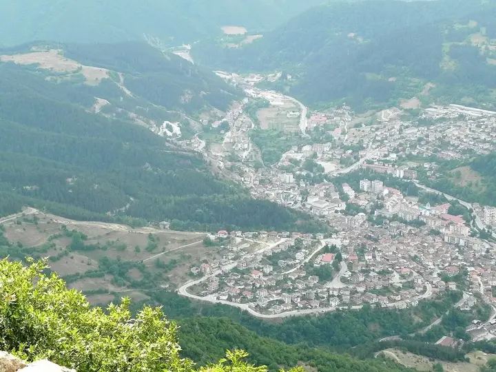 Devin32 km from the centre in a straight lineA town in the Western Rhodopes on the Devinska River, known for its Devin bottled water and its hotels. The Struilitsa eco area lies along the river, and a branch of the riverside eco trail leads to the Samodivsko Praskalo waterfall. The town is a handy base for Trigrad, Yagodina and Shiroka Laka.
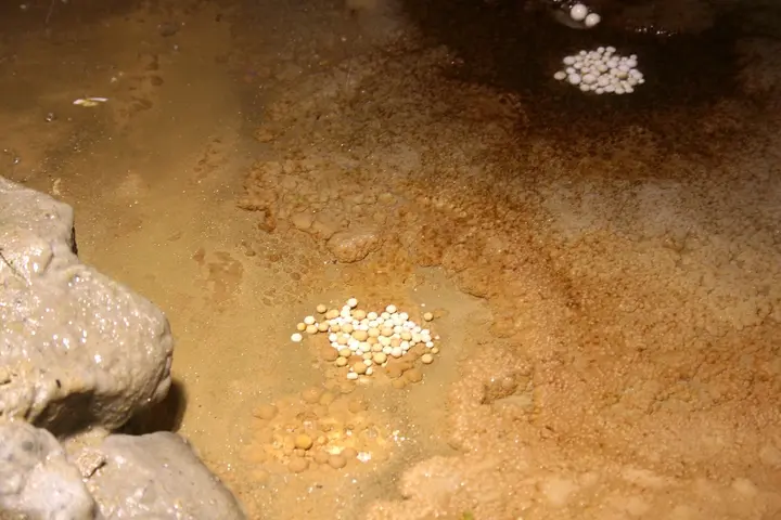 Yagodinska Cave32 km from the centre in a straight lineThe longest cave in the Rhodopes, 10.5 km, formed on three levels in marble. The show route is 1,100 m long and passes stalactites, stalagmites, draperies and cave pearls, and the guided tour takes about 45 minutes. The temperature inside is a constant 6 °C or so, so bring a jacket.
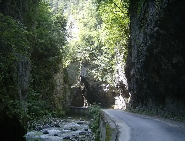 Buynovo Gorge32 km from the centre in a straight lineA gorge of the Buynovska River about 16 km long, cut entirely into marble between the village of Buynovo and the Teshel reservoir. Past Yagodinska Cave it becomes so narrow that at one point the rock walls almost touch; locals call the spot the Wolf's Leap. A paved road runs through it, so it is easy to see by car with short walks.
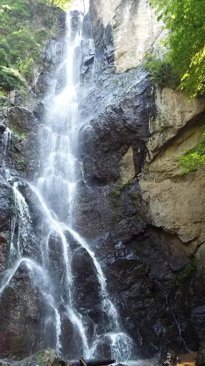 Samodivsko Praskalo Waterfall36 km from the centre in a straight lineA double waterfall about 70 m high (25 and 45 m) on a right tributary of the Devinska River west of Devin, in the Struilitsa area. It is reached by a branch off the eco trail along the Devinska River. It is at its fullest in spring and autumn.
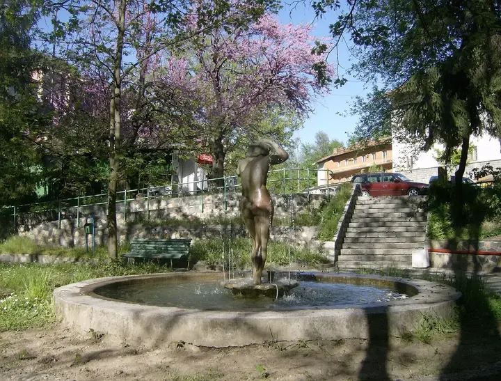 Narechenski Bani36 km from the centre in a straight lineOne of the best-known spa resorts in Bulgaria, in the valley of the Chepelarska River on the road to Plovdiv. The first public bath here opened in 1910, and the radon mineral water ranges from 11 to 29 °C. There are three mineral springs by the main road, and most of the water is suitable for drinking.
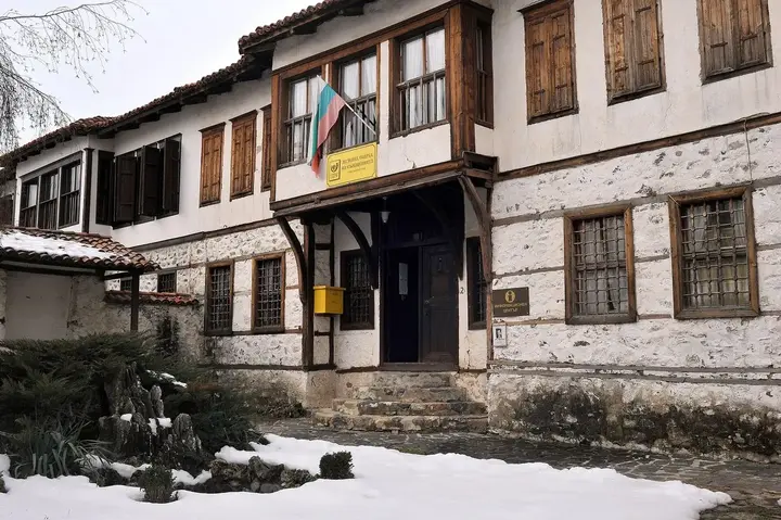 Zlatograd Ethnographic Area Complex37 km from the centre in a straight lineAn old quarter of National Revival houses in the centre of Zlatograd, holding an ethnographic museum and craft workshops where masters demonstrate traditional crafts. People live in the houses all year round, so the complex is a living part of the town rather than just a museum.
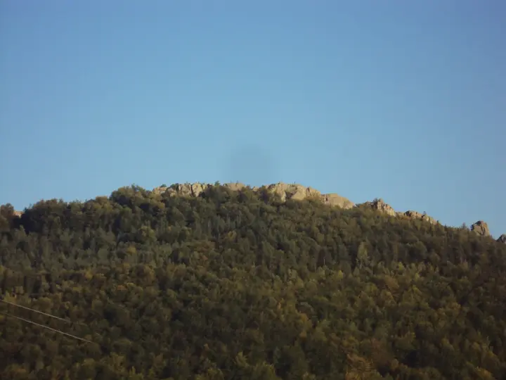 Belintash37 km from the centre in a straight lineA rock plateau about 300 m long at 1,225 m above the villages of Mostovo, Topolovo and Dolnoslav, with carved round holes, channels, niches and steps. It is thought to be an ancient sanctuary later dedicated to the Thracian god Sabazios, and is the second largest rock sanctuary in Bulgaria after Perperikon. It is close as the crow flies, but the drive from Smolyan is more than 100 km.
- Amzovo Forest Park2 km from the centre in a straight lineA forest park near Smolyan, set up in 2015 by the Fun in the Mountain association next to the Amzovo reserve. It has a pond, a barbecue area, an outdoor gym, tree houses, a playground and a forest classroom, and for the bolder there is a rope course and zip lines of 80 and 180 m, used only with the instructors. A wooden ramp from the road makes it easy to get in with a pushchair.
- Orlova Skala (Eagle Rock)2 km from the centre in a straight lineA little-known rock above the road to Turyan with the most complete view of Smolyan and all its quarters: Ezerovo, Kaptazha, Smolyan, Raykovo and Ustovo. The waymarks start next to the Karlak bridge at the very beginning of the road to Turyan. The climb is steep and tiring and the platform at the top has no railings, so keep children close.
- Kaleto Fortress above Smolyan3 km from the centre in a straight lineThe remains of a late antique fortress on a rocky peak in the Turluka area, part of the chain of Rhodope fortresses built under Emperor Justinian I. Its whole southern wall has been uncovered: it is 38 m long and stands up to 2.5 m high, and the summit overlooks the entire town. From the car park by St. Panteleimon Monastery the path is about 600 m long and takes half an hour; you can also walk up from town along the green waymarks above the cemetery (about 2.8 km).
- Smolyan Waterfall3 km from the centre in a straight lineA 20-metre waterfall on the Kriva River, hidden among the houses of the Chilingirska mahala at the western edge of town. The spot is called Salihagovata Urva and was declared a natural landmark in 1968. A path of about 100 m leads from the road to Mugla to the foot of the falls, so it takes only a few minutes to get there.
- Sokolitsite Rocks5 km from the centre in a straight lineFive rocky peaks of almost the same height, about 1,700 m, lined up from north to south above the road from Smolyan to Pamporovo. A marked path leads only to the northernmost one, which has a large metal cross on top. The path is about 1 km long and takes half an hour, but the last 400 m are very steep. From the top you can see Smolyan, Perelik, Pamporovo and the peaks of Prespa and Svoboda.
- Chervenata Skala (Red Rock)5 km from the centre in a straight lineA huge rhyolite block more than 100 m high in the massif of Golyamata Stena peak above the western end of Smolyan. Its name comes from the reddish colour it takes on at sunrise. From the top you can see the town, the Snezhanka tower and Orpheus Rocks. The route from town is about 2.6 km long and takes around two hours; the last 100 m are very steep, so stay on the marked path.
- Hadzhichonev House, Ustovo6 km from the centre in a straight lineA National Revival house next to St. Nicholas Church, one of the most notable in Ustovo together with the Sheremetev and Petko Takov houses. It is run by the Rodopski Hayduti association, which is turning it into a museum of Rhodope heritage. Check that it is open before you go.
- Kaleto Fortress near Koshnitsa8 km from the centre in a straight lineA restored medieval fortress on a 1,006-metre marble peak above the village of Koshnitsa, reached through a huge natural arch cave. Together with the Kale above Smolyan it guarded the route across the central Rhodopes between Thrace and the Aegean. The climb up the steep marked path from the main road takes about half an hour, and the top looks over Koshnitsa and the Arda valley.
- Golubovitsa Cave8 km from the centre in a straight lineA system of four caves near Koshnitsa, the most interesting of which is the water cave Golubovitsa 2 with an underground lake and river that you cross in a rubber boat wearing a waterproof suit. Entry is only with a caving guide, and the whole adventure, including the briefing, takes 1.5 to 2 hours. The path starts from the shelter by the road between Koshnitsa and Mogilitsa and goes through the beech forest of the Garga Dere route, which also has a via ferrata and a zip line over the river.
- Studenets Hut8 km from the centre in a straight lineA mountain hut in the middle of Pamporovo, at 1,646 m north of Snezhanka Peak, with 72 beds in studios and double rooms with private bathrooms. It is run by the Karlak tourist society from Smolyan. Snezhanka and Orpheus Rocks can be reached from here on foot or by chairlift.
- Nadarska Cave9 km from the centre in a straight lineA small marble cave only 55 m long but decorated with thousands of stalactites, stalagmites and draperies. It has no lighting or paths and can only be visited with a guide from the tourist society in Mogilitsa. The entrance is at 1,150 m and takes about 20 minutes to reach on foot, and you spend about half an hour inside.
- Boduralan Peak10 km from the centre in a straight lineA rocky, alpine-looking peak above the village of Kiselchovo, 1,540 m high and almost 500 m above the village. The path starts from the upper part of Kiselchovo, and the round trip takes about three hours. Neighbouring Kartalov Kamak, a few metres lower, rises above the village of Dimovo.
- Dupchov Kamak Rock11 km from the centre in a straight lineA rock east of and above Momchilovtsi with small caves at its base that you can step into. From the top you can see the whole village, Pamporovo, Rozhen, Kartola and Kaynadin. A marked path leads up from the village centre.
- Bagpipe Museum, Stoykite11 km from the centre in a straight lineThe only bagpipe exhibition in Bulgaria, "The Bagpipe, Ancient and Eternal", opened in 2022 in Stoykite, the village of famous pipers and of Apostol Kisyov, who founded the Hundred Kaba Bagpipes orchestra. The collection was built entirely from donations and holds more than 250 items: bagpipes, tools for making them, documents, photographs and recordings from every folk region. Visits are arranged by phone.
- Tornal e Todyo Eco Trail11 km from the centre in a straight lineA route along the ridges above Momchilovtsi to Kardzhaliyski Kamak, the rock from "Tornal e Todyo", the only Rhodope work song. This is where migrant workers said goodbye to their families, because the shortest road to Kardzhali passed here. The trail starts from the village centre and follows the waymarks.
- Golyam Perelik Peak12 km from the centre in a straight lineThe highest peak of the Rhodopes, 2,191 m, and one of Bulgaria's Ten Mountain Summits. The summit itself is in a military zone and closed to visitors, but neighbouring Malak Perelik (2,147 m) is open, and its meadows look out over Smolyan and the Rhodope ridges. From the Prevala saddle about 5 km of asphalt and gravel road lead to Perelik Hut, from where the summit area is about an hour and 15 minutes on foot.
- Varhat Viewing Platform12 km from the centre in a straight lineA platform on a rocky summit at 1,351 m near Mogilitsa, opened in 2020, with a 350 m drop to the road below. The last metre and a half is made of glass, so you can look straight down. From here you can see Ardin Peak, Karlak, the Snezhanka tower, Kom Peak and many villages along the upper Arda.
- Varad Fortress13 km from the centre in a straight lineA fortress on a rocky summit at almost 1,500 m above the upper Arda, used by Thracians, Byzantines and Bulgarians. The route passes the thickest beech tree in the area, and on clear days you can see the Greek mountains of Bozdag and Kushnitsa. The trail from Mogilitsa is 19 km long, marked in red, and takes 7 to 8 hours.
- Kiselchovo Waterfall13 km from the centre in a straight lineA small waterfall about 12 m high in a narrow gorge with sheer rock walls and conifer forest near the village of Kiselchovo. The path starts at the sharp right-hand bend between the lower and upper parts of the village, follows a dirt track along the river and crosses it. The spot is very shady and damp even in summer, so watch out for slippery stones.
- Kom Peak14 km from the centre in a straight lineA free-standing cone-shaped peak, 1,568 m high, above the upper Arda, where a Thracian sanctuary has been found. Local people have restored the chapel of St. Peter on the summit and climb up on St. Peter's Day. The view from Kom is one of the widest in the area.
- Momchil Yunak Hut16 km from the centre in a straight lineA mountain hut at 1,671 m west of Haydushki Polyani, with 33 beds in the main building and bungalows and a dining room. Around it are the natural lakes of the Momchil Yunak area with carp and trout, and the Kartola ski area with two quiet runs for beginners. The hut is a stop on the European long-distance path E8, and the Rozhen area is about three hours away on foot.
- Source of the Arda River18 km from the centre in a straight lineA marked scenic trail from the Bilyanska hamlet to the source of the Arda, which springs from under an old beech tree below Ardin Peak, a few metres from the Greek border. The path crosses meadows with views of Gorna Arda, Kom and Perelik and passes the Dyadova Ryaka complex. At the spring there is a glade with shelters and fire pits. The area is a border zone, so carry your ID.
- Haramiyska Cave28 km from the centre in a straight lineAn undeveloped pothole cave in the Trigrad Gorge made up of two caves joined by a 43-metre shaft. It is 510 m long, damp in places and partly icy, so it can only be visited with an experienced guide and special gear. The guide and equipment are provided by the caving club in Trigrad, and you can also ask at the Devil's Throat ticket office.
Photos from Wikimedia Commons: Svik (CC BY-SA 3.0), Vislupus (CC BY-SA 4.0), Stoycho Bozukov (CC BY 2.5), Vislupus (CC BY-SA 4.0), Vislupus (CC BY-SA 4.0), Todor Bozhinov (CC BY-SA 4.0), Mihal Orela (CC BY 3.0), Izvora (Public domain), Dobromir Zaimov (CC BY-SA 4.0), Алиса Селезньова (CC BY-SA 3.0), Boris Dzhingarov (CC BY 2.0), Krisko26 (CC BY-SA 4.0), Krisko26 (CC BY-SA 4.0), Nikolai Karaneschev (CC BY 3.0), Rumensz (CC0), Kiril Kapustin (CC BY 2.5), Красимир Косев (CC BY 3.0), LP (CC0), Spv8 (CC0), nnnnikkkk (CC BY 2.0), Borislav krustev (CC BY-SA 4.0), Darldarl (CC BY-SA 3.0), Glupylupy stitched by Marku1988 This panoramic image was created with Panorama Perfect (stitched images may differ from reality). (CC BY-SA 3.0), Boris Dzhingarov (CC BY 2.0), Rumensz (CC BY-SA 3.0), Rumensz (CC BY-SA 3.0), Izvora (CC BY-SA 4.0), Михал Орела (CC BY 2.0), Yulka Velichkova (CC BY-SA 3.0), Алиса Селезньова (CC BY-SA 4.0), Алиса Селезньова (CC BY-SA 4.0), TodorBelomorski (CC BY-SA 4.0), Vislupus (CC BY-SA 4.0), Borislav krustev (CC BY-SA 4.0), Pearlytear (CC BY-SA 4.0), Камен Ханджиев (CC BY-SA 4.0), Красимир Ярлийски (CC BY 3.0), kevinzim (CC BY 2.0), Izvora (Public domain), Красимир Ярлийски (CC BY 3.0), Izvora (Public domain), Ggia (CC BY-SA 3.0), Vislupus (CC BY-SA 4.0)